
OVERVIEW OF RICHMOND’S BAY TRAIL
The San Francisco Bay Trail is a planned 500-mile recreational and transportation corridor encircling San Francisco and San Pablo Bays. Authorized by State legislation in 1987, cities and counties developed the Bay Trail Plan in 1989 under the auspices of the Bay Trail Project of the Association of Bay Area Governments (ABAG). About 350 miles of Bay Trail had been completed by the end of 2023.
In 2000, the Richmond City Council adopted Resolution 2-00 stating:
- “The Bay Trail will make Richmond a better place to live and work by creating new recreational opportunities for bicycling, walking, running and roller skating. facilitating access to shoreline parks, allowing residents to walk and bicycle between neighborhoods, and reducing automobile traffic and congestion.”
- “The Bay Trail will provide economic benefits to Richmond by showcasing Richmond’s beauty and recreational values, attracting visitors and new residents, and contributing to a climate that attracts new business.”

Miller/Knox Regional Shoreline by Bruce Beyaert
Richmond has 32 miles of shoreline – more than any other city on San Francisco and San Pablo Bays. Richmond also stands out as having more Bay Trail built than any other City in the nine-county Bay Area. As shown on the map, the intersection of Cutting and Garrard Boulevards at the gateway to Point Richmond represents the hub of the Bay Trail in Richmond. Four spokes radiate out from this hub:
- South: The Shipyard 3 Trail and Ferry Point Loop encircling Miller/Knox Regional Shoreline
- West: The Richmond San Rafael Bridge Trail and planned Point Molate Trail
- East: Richmond’s southern shoreline with the Richmond-San Francisco Ferry Terminal, Rosie the Riveter WWII Home Front National Historical Park Visitor Center, the City’s Marina Bay parks – Shimada, Marina Bay, Barbara & Jay Vincent and Lucretia Edwards — and Point Isabel Regional Shoreline
- North: Richmond’s northern shoreline with the Wildcat Marsh & Landfill Loop trails and Point Pinole Regional Shoreline
Credit for the 36 miles of Bay Trail now built goes to the City of Richmond and the East Bay Regional Park District, as well as private development projects which incorporated important Bay Trail segments thanks to encouragement by the City and BCDC. Completing Richmond’s remaining 6.0 miles of Bay Trail will be challenging and time consuming.
NOTE: The 42 miles of planned Bay Trail exceeds the 32 miles of shoreline because the Bay Trail Plan includes loops and alternative routes for recreational and commuting uses.
Closing each gap will require access to land, planning studies, CEQA compliance, construction design and funding for each of these steps, as well as for construction itself. Cooperation of the private sector will be critical since many of the remaining gaps are located on private lands.

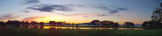
View of Miller Knox Park by Gill Stanfield
Download the colorful Bay Trail Richmond 2024 New Year Report
To receive these and other hard copy progress reports on Richmond’s Bay Trail, as well as announcements of special events, send an email to TRAC, the Trails for Richmond Action Committee.
Looking for a restaurant after your hike or bike ride? Check out the Point Richmond and Marina Bay Interactive Restaurant and Cafe Map