INTERPRETIVE
EXHIBITS
The Bay Trail in Richmond is enriched by a wonderful variety of exhibit panels and sculptures telling 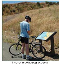 fascinating
stories about the varied history of Richmond’s shoreline
and interpreting its tidal wetlands, wildlife and offshore islands. fascinating
stories about the varied history of Richmond’s shoreline
and interpreting its tidal wetlands, wildlife and offshore islands.
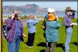
As one Bay Trail user emailed TRAC:
“The
panels add important value to the experience of people who use
the Bay Trail and shoreline parks. I notice a lot of people looking
at them. Plus, I enjoy them myself, even though I've been around
here for a long time. The panels help put the whole shoreline
experience and our area into a context the users would probably
never know about otherwise.”
Explore the following sections
of the Bay Trail to learn about the rich cultural and natural
history of Richmond’s shoreline.
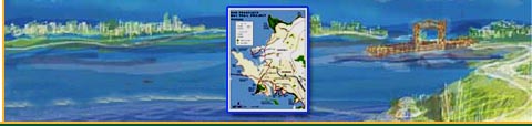
Point Pinole Regional
Shoreline: Exhibits describe 80 years of explosives
manufacturing history and current habitats. Note:Point
Pinole Regional Shoreline is part of the East Bay Regional
Park District
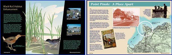
Graphic Design by Doyle Wegner, with
text by Dave Zuckermann, East Bay Regional Park District
Landfill Loop
Trail: 10
diverse exhibits about tidal wetlands, wildlife and operations at
the former landfill.
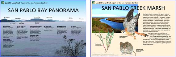
Graphic Design by Jan Brown of Spokewise with
text by Donald Bastin
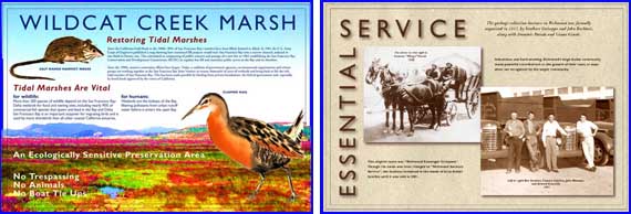 Graphic Design by
Bette Tarr of Tarrafirma with text by Donald Bastin and
Fraser Felter
Graphic Design by
Bette Tarr of Tarrafirma with text by Donald Bastin and
Fraser Felter
Ferry Point Loop: Six exhibit panels in Miller/Knox
Regional Shoreline between Ferry Point tunnel and Ferry Point
itself plus Eight panels along Seacliff Drive and Brickyard
Cove Road Bay Trail interpret a wide variety of cultural and
natural history topics.
Graphic Design by Bette Tarr of Tarrafirma with
text by Donald Bastin and Fraser Felter
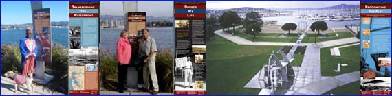
Marina Bay: As
part of the Rosie
The Riveter/WW II Home Front National Historical Park, there
are eight
sculptural historical markers plus landscape-scale
sculptural exhibits along the Bay Trail and within four
shoreline parks telling fascinating stories of the WW
II Home Front ship building effort and the resulting
transformation of Richmond’s
shoreline and culture.
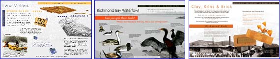
Eastshore
State Park -- Marina Bay to Point Isabel Regional Shoreline: Exhibit
panels describe tidal marsh wildlife and Ohlone Indian life.
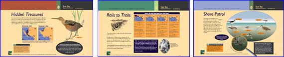
Hidden
Treasures Rails
to Trails Shore
Patrol
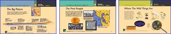
The
Big Picture The
First People Where
The Wild Things Are
Interpretive exhibits originally
Designed by Leslie Stone.
Design modification and new illustrations by Doyle Wegner,
Exhibit Design, EBRPD
Photos courtesy of Ellen
Gailing, Michael
Alford and David Moore
|